Visit Date: 10/19/2013 (Best Viewing Time: early October to mid November)
Oku-Nikko is located in the northwestern part of of Nikko, a city in the mountains of Tochigi Prefecture, which is approximately 140 km north of Tokyo. Oku-Nikko forms a part of the Nikko National Park and offers a scenic beauty of the mountain landscapes, marshes and lakes, waterfalls, hot springs, wild monkeys, and hiking trails. The Oku-Nikko area is also well-known for its beautiful autumn colors and provides an excellent walk with nature.
Contents
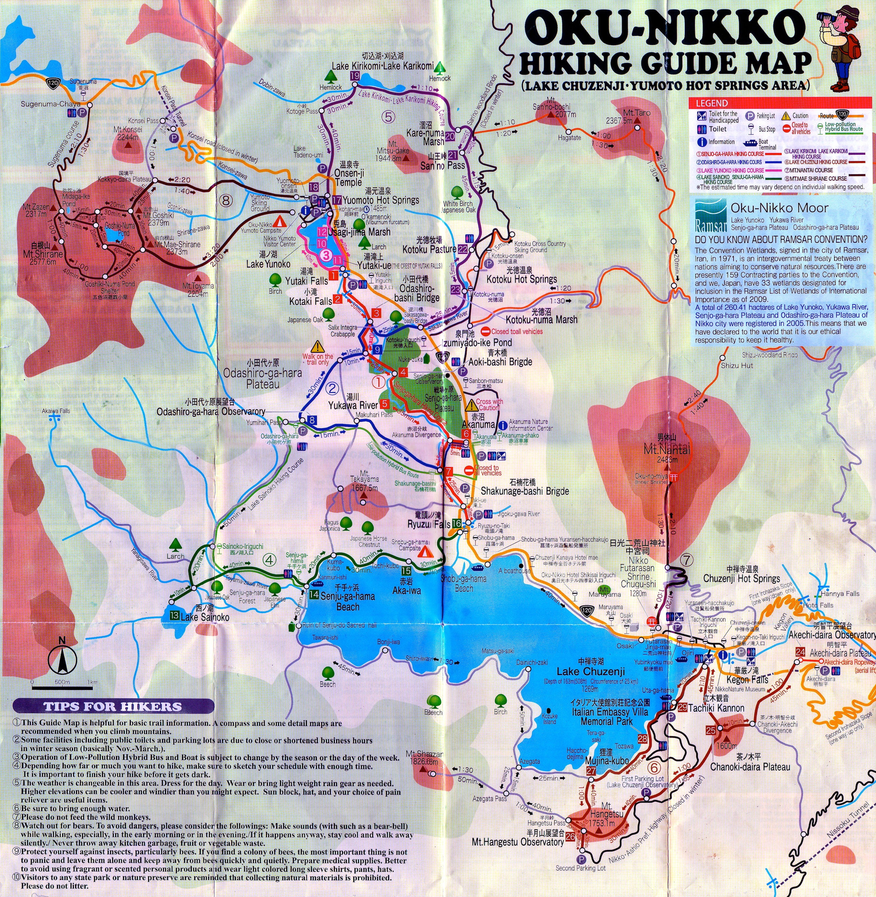
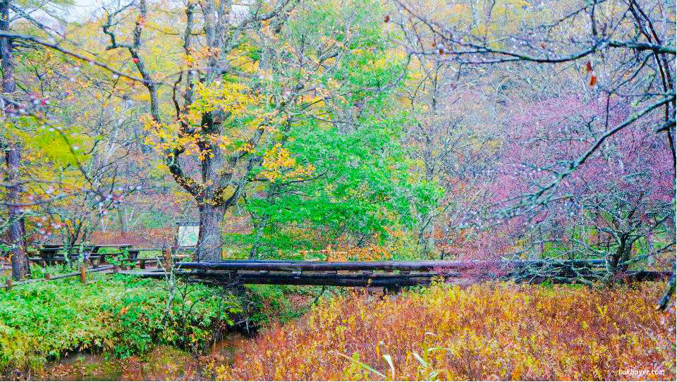
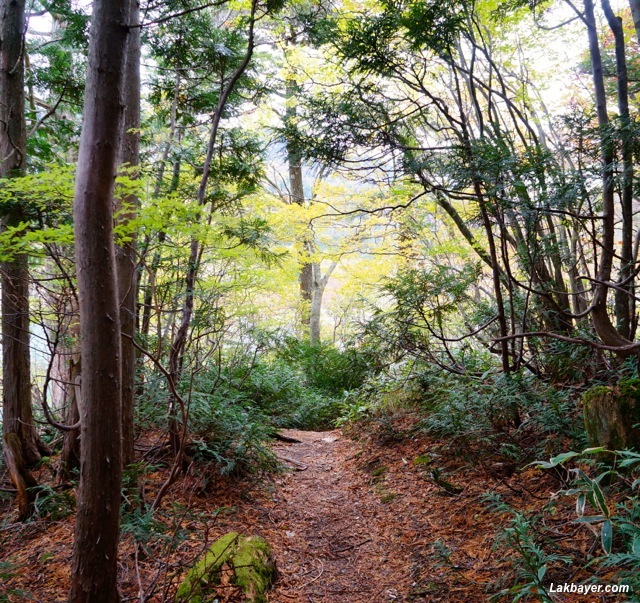
Senjogahara Hiking Course

The Senjogahara Plateau Nature Trail is the most popular hiking trail in the Oku-Nikko area. It is a nice and easy walk that follows Yukawa River during most of its course between Yutaki and Ryuzu Waterfalls. The trail takes mostly a walk on a boardwalk up a gentle slope which is suitable for the whole family. It passes through beautiful sceneries of the marsh, waterfalls and surrounding mountains. There are also many places to stop for a picnic lunch.
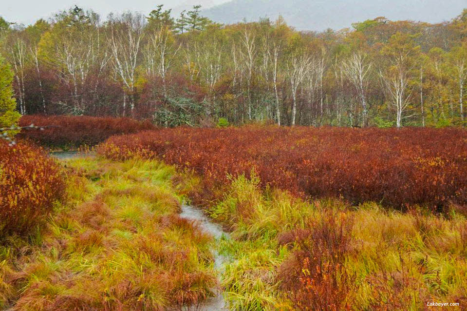
The Senjogahara marshland is located at an altitude of 1,400 meters above sea level with an area of about 400 hectares. It is very popular during summer months when alpine flowers and plants are in season and visitors can enjoy the chirping of wild birds or during the autumn season when the marshland’s grasses turn into reddish yellow and the larch trees into shiny gold.
The course is about 6.3 kilometers long and takes around 2.5 to 3 hours. It passes through Yutaki Falls -> Kotaki Falls -> Odashiro-Bashi Bridge -> Aoki-Bashi Bridge -> Yukawa River -> Aka-numa Marsh -> Shakunage-Bashi Bridge -> Taki-ue -> Ryuzu Waterfalls
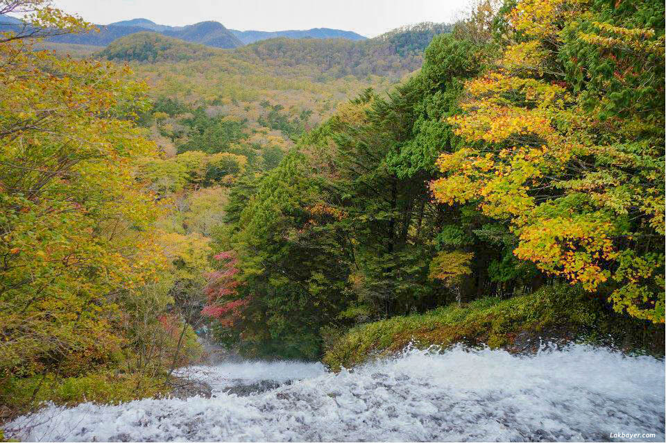
Yutaki Falls
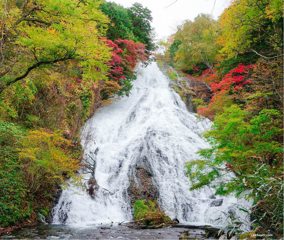
One of the three famous falls in Oku-Nikko. It is located in the southern edge of Lake Yunoko. It is 70 meters high and 25 meters wide. The best viewing spot is from the observatory at the basin of the falls.
Kotaki Falls

With a height of only 5 meters, it is a small but lovely waterfall which harmonizes with nature and mysterious green woods.
Odashiro-Bashi Bridge
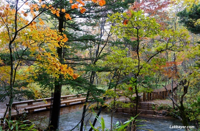
A wooden bridge over Yukawa River parting an entrance to Kotoku. Some of the fallen trees around the bridge have been covered with moss creating a more jungle-like atmosphere.
Aoki-Bashi Bridge
Also built over Yukawa River and has a big crabapple tree. The bridge provides a good view of the river and the bridge itself blends perfectly with nature.
Yukawa River
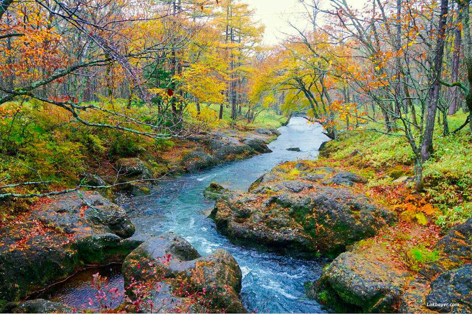
The river is about 12.4 kilometers in length and starts from Yutaki Falls. It flows gently through Senjogahara plateau in a zigzag direction. It changes its name to Jigoku-gawa River after passing through Ryuzu Falls until it finally reaches Shobugahama Beach in Lake Chuzenji.
Taki-ue
The bus stop in the crest of Ryuzu Falls which is a great spot to view the powerful water current. It is especially beautiful during the autumn season when spectacular blazing fall colors combines with the water that looks impressively white in color.
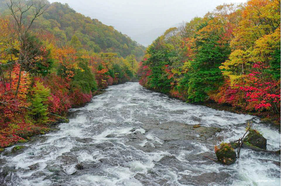
Ryuzu Falls
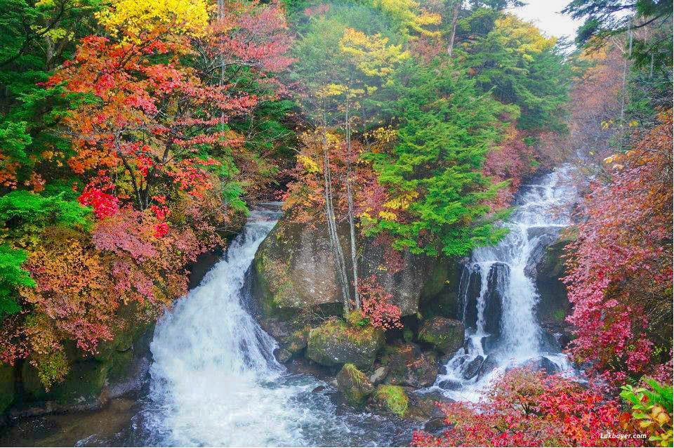
One of the three most famous falls in Oku-Nikko area. It is 60 meters high and 10 meters wide. Ryuzu no take means “dragon head waterfall” and the name comes from the shape of the falls – the basin of the falls are divided into two rocks and resembles the head of a dragon. Visitors can enjoy the beauty of the azaleas in spring and the impressive colors of yellow and red during the autumn leaf season.
![]()
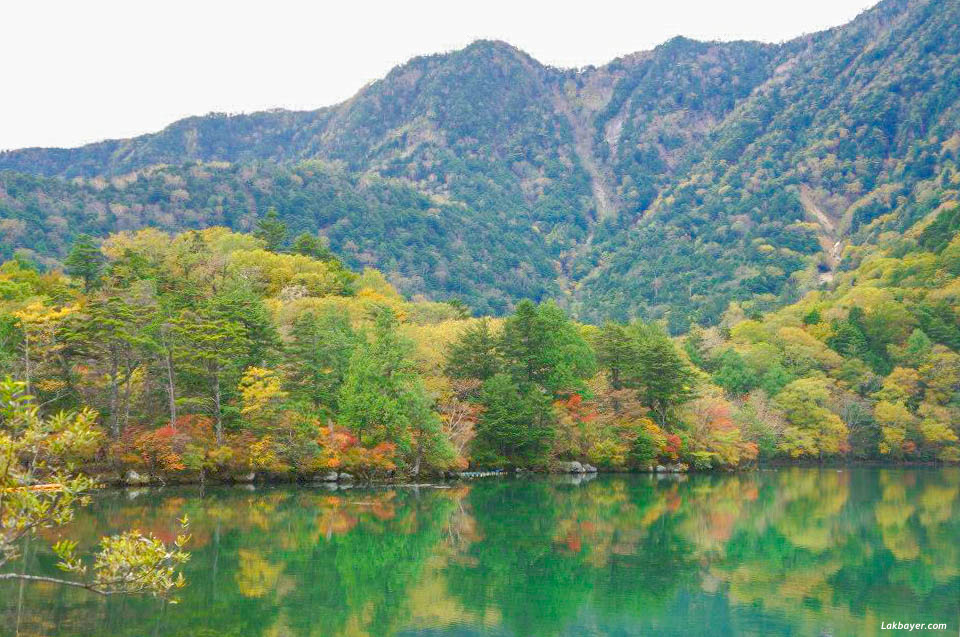
Lake Yunoko Round Course
The Lake Yunoko hiking course is another popular and easy trail in Oku-Nikko and goes around the lovely lakeshore. It has an altitude of 1,478 meters above sea level and a circumference of 3 kilometers.
The trail on the east side of the lake follows the road at times but there are quiet pockets where visitors can feel completely immersed with nature – with fallen trees, moss, meadows, and alcoves. The west side of the lake, however, has kept its peaceful atmosphere and passes through a conifer forest with a soft and comfortable ground cushioned with dried leaves. The Yumoto Hot Spring is located in the northern part of the lake.
Most hikers get to Lake Yunoko by hiking up from Senjogahara plateau or via the Tobu Nikko bus, alighting on the Kohan-mae bus stop. Rental boats are also available at the Nikko-Yumoto Rest House. The trail provides a little bit of everything – visitors can enjoy viewing the flowers, various broad-leaf trees, and wild birds around the lake during summer or the beautiful colored mountain reflection on the surface of the lake during autumn.
The walk around the lake takes about 1 hour and passes through Lake Yunoko -> Usagi-Jima -> Yutaki-ue
Lake Yunoko
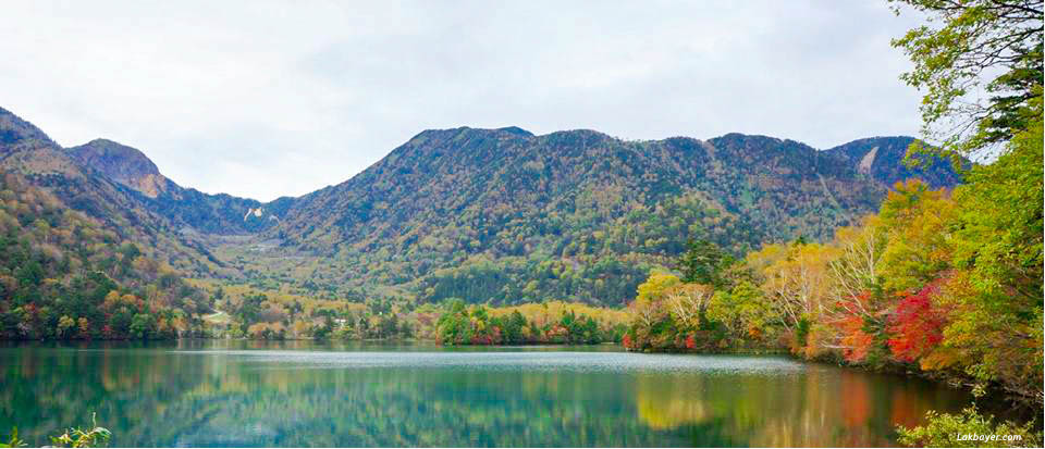
A small lake located just north of Senjogahara marshland and is located about 6 kilometers north-west of Lake Chuzenji. The landscape of the lake was created through the eruption of the Mt. Mitsudake about 20,000 years ago.
Usagi-Jima

‘Usagi’ means ‘rabbit’ in Japanese and this peninsula in Lake Yunoko is named as such because it looks like an ear of the rabbit when viewed from the sky. The mesmerizing palette of autumn leaves all over the peninsula will surely take the visitors breath away.
Yutaki-ue
The peak of the Yutaki Falls is located in the southern shore of Lake Yunoko. It is a spectacular view point to watch the powerful water streaming to the waterfalls. It takes around 10 minutes hike from the crest to the observatory at the basin of the falls.
![]()
Odashirogahara Hiking Course
The walk along the 7.2 kilometers Odashirogahara Plateau Nature Trail takes around 2 to 2.5 hours. It provides lovely mountain views, flowers, and marshlands with course mostly on a boardwalk passing through Odashirogahara Plateau -> Odashirogahara Observatory -> Izumi-yado Ike Pond.
Odashirogahara Plateau
The plateau is located at the west of Yukawa River and is about 2 kilometers in circumference. It is smaller but is an equally charming marshland with the width of about only 1/4 of Senjogahara plateau. The plateau is surrounded by forest of Japanese oak with a few kinds of plants growing in colonies during summer. The plateau is also interesting during autumn, when the yellow leaves and the swaying autumnal grasses give an admirable view of the marshland.
Odashirogahara Observatory
The observatory is a good lookout point to explore the panoramic view of the Odashirogahara marshland. Various types of trees can be seen from the observatory.
Izumi-yado Ike Pond
The pond is located on the western edge and full of pure spring water. The clean water, fallen timers, and dead trees creates a mystic atmosphere.
![]()
Lake Chuzenji Hiking Course
This course takes a hilly lakeside walking trails which is long and difficult with lots divergence with mostly steep up hills and down hills towards Mujina-kubo. The 11 kilometers hike takes approximately 5 hours and passes through Akechidaira Observatory -> Chanokidaira Plateau -> Mt. Hangetsu Observatory -> Mujina-kubo -> Italian Embassy Villa Memorial Park -> Wooden Statue of Tachiki-Kannon.
Akechidaira Observatory
The Akechidaira plateau provides a impressive view of Lake Chuzenji, Kegon Falls, Mt. Nantai, Shirakumo waterfall, and Byobu-Iwa Cliff. The observatory also provides a good viewing spot for azaleas during summer and colorful leaves during autumn. It is reachable through a 5 minute ride through the ropeway.
Chanokidaira Plateau
It is another observatory with a botanical garden, which is more popular for the panoramic view of Lake Chuzenji. It is about 1,600 meters above sea level.
Mt. Hangetsu Observatory
The view from this observatory provides equal beauty from the Akechidaira plateau. It offers scenic view of Mt. Nantai, Lake Chuzenji, Senjogahara plateau, and Mt. Nikko Shirane.
Italian Embassy Villa Memorial Park
Founded in 1928, this villa was used as a summer retreat house of the Italian Ambassadors towards Japan. It is located in the southern shore of Lake Chuzenji and has a marvelous view of the lake and mountains. The main residence is now a museum, which displays furnitures and other goods in the old days.
Wooden Statue of Tachiki-Kannon
‘Tachiki-Kannon’ is a popular name for Senju-Kannon, which is a thousand armed Goddess Of Mercy enshrined in Chuzenji Temple. There is a legend that this statue was carved by the priest Shodo himself when he saw Senju-Kannon appearing from the Lake Sainoko.
![]()
![]()
Useful Info:
Nikko Tourist Information Center
Address: 591 Goko-machi Nikko, Tochigi 〒 321-1404
Access: 10 min walk from JR/Tobu Nikko station. 3 min bus ride from JR/Tobu Nikko station, get off ⑤ bus stop.
Website Site: nikko-jp.org
Inquiries: +81-288-54-2496
Hours: 9:00 – 17:00
* Brochures and leaflets are available in English, Chinese and Korean.
References:
☛ Oku-Nikko HIking Guide Map
☛ Japan Guide
☛ Trip Advisor
☛ Nikko-JP.org
☛ Tobu.Co.Jp